Denver, Colorado and the Rocky Mountains
In the next flyby, we leave the Great Plains abruptly as the Front Range of the Rocky Mountains rises dramatically from the gently sloping high plains. In the Denver area, much of this zone is taken up by steep-dipping sedimentary rocks that make a feature known as “hogbacks”. Both a summer and a winter Landsat MSS full scene show the plains, the Front, and the high mountains of Colorado in the Denver area.
Denver, Colorado and the Rocky Mountains
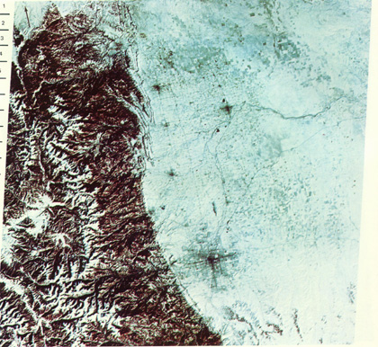
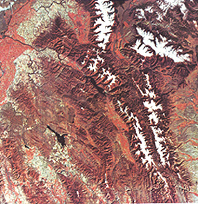
The boundary zone between the Great Plains and the eastern Front of the Rocky Mountains is abrupt, with the transition zone generally less than 1-2 km (0.6-1.2 miles) wide. The 700 km wide scene taken by the Day-Vis channel on the Heat Capacity Mapping Mission (HCMM) sensor shows much of the southern end of the Rockies from northern New Mexico into the southern half of Wyoming. The map below it indicates that the entire state of Colorado is included in the image.

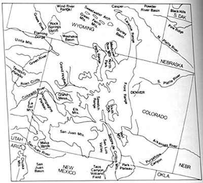
In this part of the United States the uplifted and folded rocks making up the true Rocky Mountains occupy a relatively narrow strip passing through the central part of Colorado and New Mexico, and swinging northwest through most of Wyoming (the Wind River Mtns mark the shift that carries the Rockies into Idaho and Montana). The principal units in Colorado are the Front Range and the Sawatch Range. This limited width of the orogenic belt comprising the Rockies may seem a surprise because once in these mountains, their lofty grandeur gives an impression that they extend well to the west. In fact, from western Colorado into Utah, mountains of a different type, found in the Colorado Plateau (next page), are predominant. The San Juan Mountains look to the traveler much like the Rockies but they are actually a great pile of highly dissected volcanic flow units intermixed with sedimentary rocks and are considered a separate unit. Note the Uinta Mountains in Utah - the only dominantly east-west mountain system in the U.S.
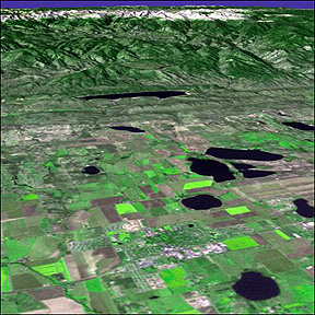
The Front is well displayed by this perspective natural color image using Landsat 7 data merged with DEM topographic data.The area shown are the high plains around Greeley, Colorado, with a reservoir in the foothills near Fort Collins.
The Rocky Mountain National Park is in the background, near the snow-capped high mountains near Estes Park. This popular destination for tourists is shown in the image below, made from combining a Landsat TM scene with DEM data:
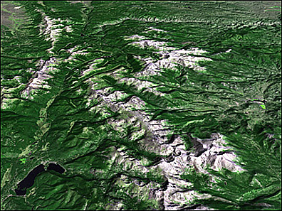
The Park contains a considerable number of high peaks above 11000 feet, which offer challenges to both experienced and novice mountain climbers. In 1955 the writer (NMS) climbed first Hallett’s Peak (12743 ft) and then the second tallest in Colorado, Longs Peak, at 14255 ft (the last 1000 of which proved an ordeal). Longs Peak is in the cluster of snow-covered mountains off to the east near the bottom right. The main line of snow-capped mountains form the Continental Divide; those at the top of the image, offset east of the Divide, are the Mummy Range group. This next photo was taken at 10000 ft looking at the East Face of Longs Peak; our ascent was not that vertical facing but along the ridge line running up from right to left.
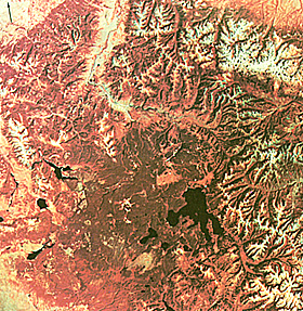
The Park is included in this false color composite of central Colorado acquired soon after the launch of Landsat 1.
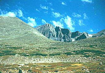
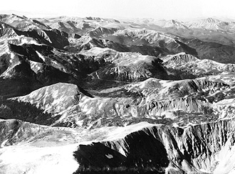
These mountains form the eastern edge of the North American Cordillera, which is made of groups of diverse, usually complexly-folded and faulted blocks of crust. The blocks are uplifted or thrust against other blocks separated by structural basins. They were deformed and emplaced during periods of major orogenies that were often disconnected in time and place. Rock units in the Rockies were finally compressed and shoved upwards about 65-70 million years ago. The present topography of these mountains is the result of strong erosion thereafter that has lowered their original heights to under 4,420 meters (14,500 ft). Alpine glaciation has steepened and widened already deep valleys, creating the rugged vistas that make this region especially popular for tourists and skiers. The photo below shows a typical landscape within this part of the Rocky Mountains.
The barren (whitish) area along the crest of the Front Range in this image coincides with the Continental Divide where it sits above the treeline. The slopes below are forested with Douglas fir, spruce, pine, and aspen trees. Rocky Mountain National Park is in the left center of the image. The southern end of the Medicine Bow Range in Wyoming extends into the image at the top left.
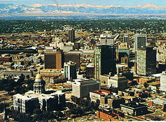
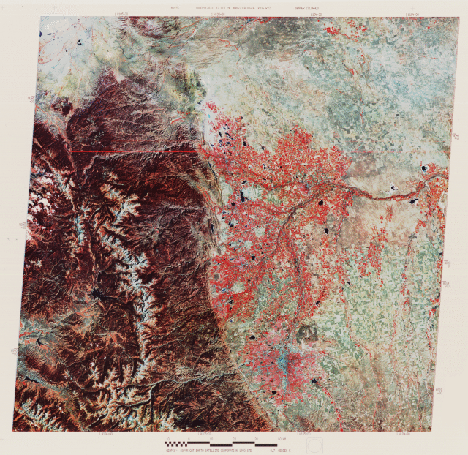
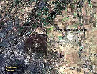
Returning to the image, to the right of the bluish downtown is a large square which is the Rocky Mountain Arsenal, once used for storage of military weapons. This can be easily seen in this 5 meter resolution Indian IRS-2 satellite subscene; note also the new International Airport east of the city.
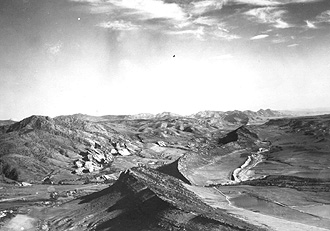
To Denver’s west, against the mountains, are thin elongated strips with yellowish and brownish colors. These strips are “hogbacks,” which were steeply dipping sedimentary rocks, inclined down to the east as the Front Range rocks were pushed upwards. Those hogbacks with yellow tones are actually reddish (the Red Rocks Park contains them) but have this color variant in the false-color mode. They are quite evident in this aerial oblique view taken along the Front south of Denver.
Red colors within Denver and around Boulder and Fort Collins signify trees and crops still bright in the near-IR in this October scene. Their distribution is affected by proximity to the Platte and other rivers. These rivers provide irrigation for the alfalfa, hay, oats, corn, beets, and barley grown in this part of the Plains. Uncultivated areas, such as the Pawnee Grasslands (brownish patch at the right center), contain buffalo and grama grasses.
A January 1973 winter view of Denver places the region in a rather different perspective. One consequence is the “heat island” effect of towns and cities, in which melting and snow-plot removal cause the streets and roofs to appear very dark from the loss of the snow cover.
` <>`__6-9: This winter scene brings out the infrastructure of much of Denver. Four large towns are now visible to the north; name them. Are they visible in the summer scene. Explain the brownish color associated with the Rockies. Is there snow above the treeline? What factor(s) help(s) to indicate drainage patterns. What happened to the lakes so visible in the summer image? `ANSWER <Sect6_zanswers.html#6-9>`__
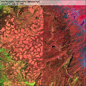
Nestled within the broad stretch of the Rocky Mountains as they pass through northwestern Wyoming is America’s first National Park: Yellowstone. Here is a view from space:
Yellowstone is the site of widespread volcanism erupting from now buried calderas. Activity has been recent - the last eruptive flows were in the Pleistocene less than 1,000,000 years ago. Groundwater that seeps down to the still hot subsurface lavas is responsible for the many geysers that are the trademark of this Park. Yellowstone Lake occupies a darker area (evergreens) near the image center. The Absaroka Mountains line the east side of the Park; these continue into the Beartooth Mountains to their north. Look in this image about due west (left) of Yellowstone Lake - this is how it appears in a Landsat-7 ETM+ subscene: grazing and clearcut forests are to the left (west); fully preserved forestlands are on the right; the sharp boundary is related to a fenceline (this effect is similar to the U.S.-Canadian boundary shown on the previous page):
The next scene to the south of Yellowstone contains some of the most spectacular scenery in America. Consider:
The Tetons are the up-down range at top center. To their east are the E-W Gros Ventre Mountains (those who know French should try to translate these names, given by French trappers in the 18th century). The two curving ranges below are the Wyoming and Hoback ranges. The beginning of the Snake River Plains (page 6-8) appear in the upper left.
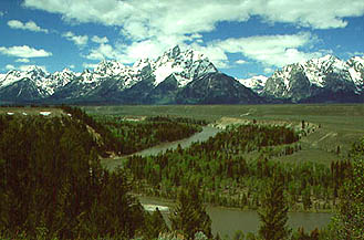
The Tetons are hugely photogenic (backdrop in the movie “Shane”). Here is a panoramic view from the alluvial plains through which the Snake River flows”:
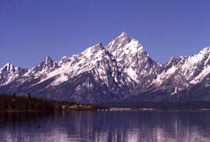
or sentimental reasons, the writer (who has done geological field work in all these ranges) includes this last photo - the Tetons from Jenny Lake, where he and his wife spent their honeymoon in 1961 (which did not include any mountain-climbing).
Fit these images, which show the beauty of the Tetons close-up, with this perspective view of the entire range, the Snake River Plains, and the Hoback Range to the south as constructed from a Landsat-7 natural color composite and STRM elevation data:
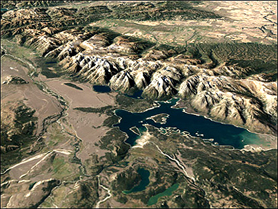
This perspective discloses the Tetons to be a block fault mountain range in which the east side is thrust upwards as a swinging motion. Thus, the west slope is gently inclined, so much so that bicyclists have reached the crest whereas those climbing from the east side must use ropes and other such advanced scaling equipment.