Label : Moroccoevapotranspirationgeographic information
Date: 2023-09-16
View counts: 323
Download Dataset: Log in
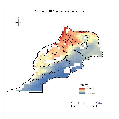
The Evapotranspiration data of Morocco in 2017 can be classified, cut and synthesized with the help of ArcGIS software, and the evapotranspiration data of Morocco in 12 months in 2017 can be obtained.Three widely used model-based EVAPOtranspiration datasets, including ERA5, MERRA2 and GLDAS2-Noah reanalysis data, were used to select fusion regions with high consistency using coefficient of variation, and the EVapotranspiration datasets were obtained and stored in NetCDF format based on reliability ensemble average method. Represents the actual evapotranspiration over land, measured in millimeters (mm). The data set contains three dimensions: longitude, latitude, and time.
Comment list ( 0 )

