Login   |      Register
English    中文


ESRI Morocco land cover data for 2020


ESRI Morocco land cover data for 2020

Label :

Date: 2023-09-16

View counts: 181

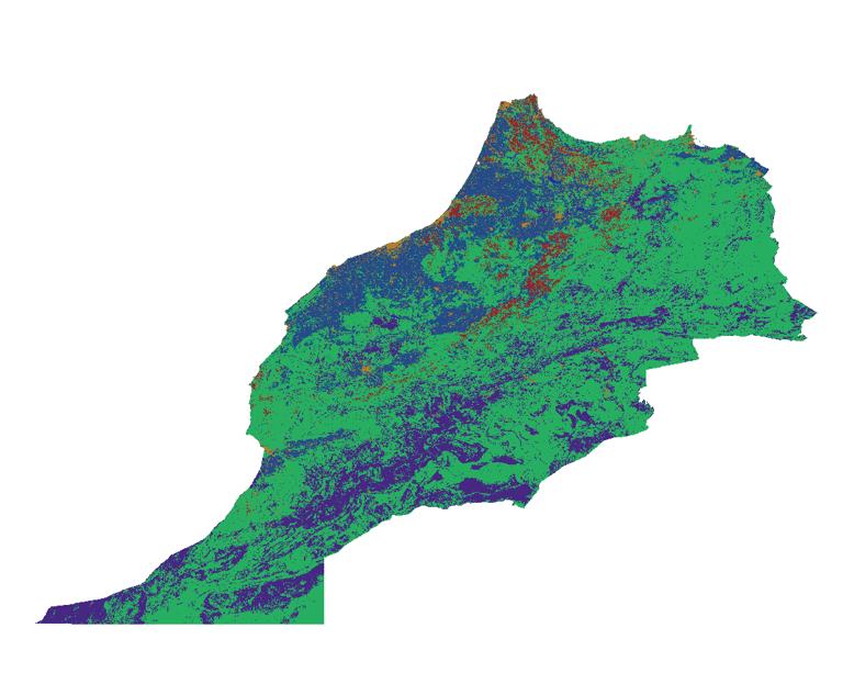
Esri_Land_Cover_2020_10m data source is Esri, based on 10m sentinel image data, using deep learning methods to produce global land cover data, the overall accuracy of the data is 85%. ESRI Morocco land cover data for 2020 was tailored to this.

Title alternate
ESRI Morocco land cover data for 2020
Parent identifier
Remote sensing image
Topicategory
Geophysical
Language
English
Type
raster
Format
tif
Time begin
2020-01-01
Time end
2020-12-31
Creator
ESRI
Publisher
IKCEST-DRR
Contributor
ESRI
Organization
IKCEST-DRR
Operateson
ESRI
Source
https://esri.maps.arcgis.com/apps/instant/media/index.html?appid=fc92d38533d440078f17678ebc20e8e2

    Sign in for comments!

Comment list ( 0 )