Login   |      Register
English    中文


The hydrologic database of Songliao basin in northeast of China


The hydrologic database of Songliao basin in northeast of China

Label :

Date: 2018-01-25

View counts: 8193

Browse document: Browse document

Download Dataset: Log in

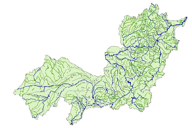
Based on the reconnaissance and analysis technology, the data set is made up of the reconnaissance and analysis results and the interpretation of remote sensing, and the spatial reference (projection and coordinate system) is Albers. The survey results images are derived and read in software ArcMap, using a variety of tools for a map, based on the scale of standard framing way of interpretation, the formation of vector data is formed into the file. Finally, the data is exported in the vector file. The hydrologic data of river, lake, reservoir and the basin range were extracted from the file library to build the hydrologic database of Songliao basin.

Topicategory
Geography
Language
English
Time begin
2001
Time end
2017
Contributor
Bu Kun Email: bukun@osgeo.cn
Organization
Northeast Institute of Geography and Agroecology, Chinese Academy of Sciences.
Access constraints
Sharing Type: Open
Contributor agency
Northeast Institute of Geography and Agroecology, Chinese Academy ofSciencess
Contributor email
bukun@osgeo.cn
Country id
CN
Data citation
The hydrologic database of Songliao basin in northeast of China.Disaster Risk Reduction Knowledge Service of International Knowledge Centre for Engineering Sciences and Technology (IKCEST) under the Auspices of UNESCO, 2017.11.10. http://drr.ikcest.org/info/99c36.
Data record num
4.9MB
Resperson name
Northeast Institute of Geography and Agroecology, Chinese Academy ofSciences
Responsible address
Shengbei Street, Number 4888,High Tech North Zone.
Responsible email
bukun@osgeo.cn
Responsible postcode
130102
Responsible telephone
010-64889048-8006
Last Modified
2017/11/10

    Sign in for comments!

Comment list ( 0 )