The Earth observation and weather forecasting industry are experiencing rapid technological advancements driven by satellite technology, AI, and data processing methods. These developments are improving our ability to monitor and predict weather events, making a significant impact on various sectors, including defense, aerospace, and disaster management. Collaboration between government agencies and industry players is crucial for advancing these capabilities.
The Earth observation (EO) industry continues to grow in technological innovation, which is driving investment opportunities for commercial and government applications. Innovations are capitalizing on new satellite communications that will improve Earth observation and subsequent weather forecasting.
"Earth weather and space weather imaging technology has made incredible leaps forward with each generation of weather satellites, and the GOES-R series of weather satellites Lockheed Martin has built for NOAA is no exception," says Jagdeep Shergill, director of geo weather programs, and lead of all Earth-related weather program execution at the Lockheed Martin Space segment in Denver.
In its first six months of operation, the U.S. Geostationary Operational Environmental Satellite (GOES)-16 transmitted more weather data than all previous GOES-series weather satellites combined. "This is largely due to the state-of-the-art suite of six instruments aboard those spacecraft, Shergill says.
Earth-observation sensing
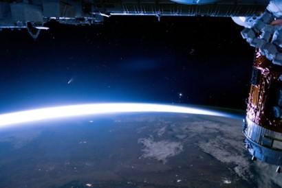
When it comes to Earth observation technology, it's important to note that it's not just a technology that applies deep into outer space; historically there has been much technology that is not so far away from Earth. "The origins of remote sensing itself are from the late 19th and early 20th centuries, says Kanna Rajan, a senior scientist at the RAND Corporation in Santa Monica, Calif., and an expert on ocean observations and ocean weather. Rajan points out that while rocket technologies have stabilized and launching Earth observation missions is relatively common, the fundamental advances in the last 20 years have come in sensors and in the actual frame of a satellite.
Imagers and radiometers, which use other parts of the electromagnetic spectrum beyond visible light, have developed substantially for optical and other means to observe the Earth. "The use of optics to provide imagery is useful, absent cloud cover," adds RAND's Rajan. "With cloud cover, other radiometric instruments, where development has been leveraged from radar-based techniques, have made substantial inroads, not just for weather, but also for security."
Computing capabilities
Brown adds that in addition to these advancements, there are significant improvements in computing capabilities as well. "Cloud platforms have made it possible to process data more efficiently and faster," brown adds. "Furthermore, applications can now be containerized, allowing them to run seamlessly across various computing environments. artificial intelligence (AI) accessibility has been greatly improved, thanks to enhanced computing power. AI algorithms now play a pivotal role in data analysis and will soon replace certain aspects of traditional physics-based weather models. Graphics Processing Units (GPUs) have become instrumental in accelerating numerical modeling, leading to improved forecast accuracy. As computing capabilities continue to advance, decentralized and quantum computing hold the promise of further enhancing forecast abilities. These advancements will drive the widespread adoption of AI capabilities in Earth observation and weather forecasting."
Advancements in data applications
Advancements in the state of technology for Earth observation and weather forecasting have enabled faster imaging and reporting and sophisticated algorithms that allow for the merging of observational data giving more accurate predictions. Notable technologies that are having an influence include satellite technology; radar systems; numerical weather prediction (NWP); weather observation systems; remote sensing techniques ; big data analytics and machine learning; high-resolution imaging; communications; and data sharing, points out Daryl Madden, vice president geospatial systems at Textron Systems in Sterling, Va.
"Technology in these areas continues to evolve rapidly, and ongoing research and development efforts will continue to enhance Earth observation and weather forecasting capabilities," Madden says. "Here at Textron Systems, we have been working with various types of geospatial data for over 25 years. We have continued to apply the latest in commercial satellite technology into our products to provide actionable insights to our users. The SeeGEO web-enabled platform has the capability to ingest, display, store and exploit geospatial data. RemoteView, our premier imagery exploitation product, allows the imagery analyst to display, measure, compare, and contrast different modalities of remote sensing data to meet their specific needs and missions."
Aircraft and Earth observation
In addition to specific advancements intrinsic to technology and data applications and processing, new aircraft are being built military and government missions.
"Lockheed Martin’s C-130 Hercules and P-3 Orion aircraft have long supported weather reconnaissance and forecasting missions for the U.S. Air Force and the National Oceanic and Atmospheric Administration (NOAA). Both turboprop airlifters are known for tracking hurricanes but are used throughout the year in gathering and conducting weather research," says Richard Cree, an engineer with Lockheed Martin Skunk Works in Palmdale, Calif. He specializes in airlift mission capabilities for aerial fire-fighting and weather reconnaissance.
Sources:
Military+Aerospace Electronics
Provided by the IKCEST Disaster Risk Reduction Knowledge Service System
Comment list ( 0 )

