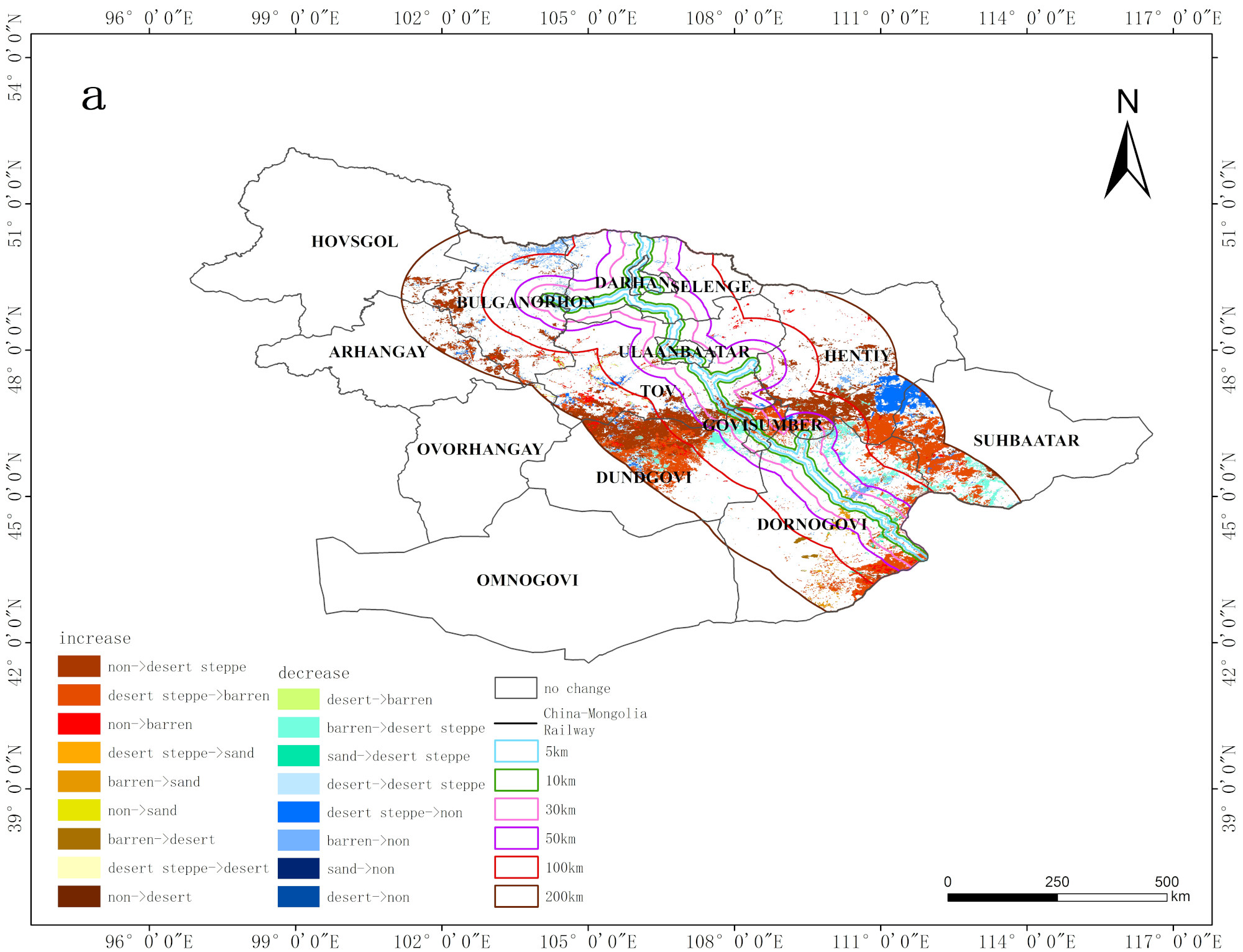
Login   |      Register
English    中文


Land degradation data set along the China-Mongolia Railway (Mongolia section)


Land degradation data set along the China-Mongolia Railway (Mongolia section)

Label :

Date: 2020-10-28

View counts: 4388

Browse document: Browse document

Download Dataset: Log in

This data set is the distribution data of land degradation along the China-Mongolia Railway (Mongolia section) from 1990 to 2010 and from 1990 to 2015. It mainly records the types of land degradation and restoration, as well as the characteristics of spatial and temporal distribution, with a total of 18 vector files. They were collected and organized by the Institute of Geographic Sciences and Natural Resources Research, Chinese Academy of Sciences. And it can provide important basis for monitoring and prevention of land degradation disaster.

Topicategory
Earth science
Time begin
1990
Time end
2010,2015
Organization
Institute of Geographic Sciences and Natural Resources Research, Chinese Academy of Sciences.
Date creation
2020.08.29
Contributor agency
Institute of Geographic Sciences and Natural Resources Research, Chinese Academy of Sciences
Contributor email
ikcest-drr@lreis.ac.cn
Country id
MN
Data citation
Land degradation data set along the China-Mongolia Railway (Mongolia section). Disaster Risk Reduction Knowledge Service of International Knowledge Centre for Engineering Sciences and Technology (IKCEST) under the Auspices of UNESCO, 2020. 08.29.
Data record num
267 MB
Resperson name
Service group of Disaster Risk Reduction Knowledge Service System of IKCEST
Responsible address
A11 Datun Road, Chaoyang District, Beijing
Responsible email
ikcest-drr@lreis.ac.cn
Responsible postcode
100101
Responsible telephone
010-64889048-8006

Data Visualization on Map

Central point longitude
107.499
Central point latitude
46.689
Max zoom level
7
Min zoom level
1
Current zoom level
4


    Sign in for comments!

Comment list ( 0 )