The Landsat Game Answers
The Landsat Game Answers
A: This is the Peloponnesean Peninsula of Greece, joined by a narrow isthmus (near center top) to the mainland. Athens is the blue are along the top a fourth of the way in from the right. The Mediterranean Sea is at the bottom; the Gulf of Corinth is at the top. Sparta is on the Peninsula. The Olympic Games first took place near Pirgos, just beyond the left edge of the image. Mt. Olympus, home of the gods, is well to the north of this image.
While we are in the neighborhood, let’s look in on this image, made by MISR on the Terra spacecraft:

The scene extends over most of the areas visited by cruise ships sailing the Aegean Sea. Among the many islands that attract tourists are Crete, Lesbos, Samos, Chios, Thira (site of a mighty explosion that destroyed the volcano Santorini in Minoan times), and the Cyclades. On Asia Minor (western Turkey) is located the town of Ephesus, visited during the travels of St. Paul.
Now, we zero in on Athens, Greece, the most famed city in the ancient world and often called The Cradle of Democracy. Athens is one of the Poli or City-State system, composed of self-governing people in a central city supported by nearby farms, that prevailed for several centuries (5th until 2nd BCE) before Greece (after the era of Alexander the Great who created the largest empire to that time) united briefly to defend against the Romans but then was conquered by them. Look first at this astronaut photo that shows the city, Marathon (the terminal point of a great race), and surrounding islands.

This Quickbird-2 image shows much of the modern city.

This next photo made from the International Space Station includes the centerpoint of both ancient and modern Greece - the limestone hill called the Acropolis and the ruins of the Parthenon:

Here is a low oblique aerial view of the Acropolis, topped by the Parthenon, the central meeting place of the Greek ruling classes. The Dionysus Theater is visible at the base of the Acropolis.

This is a reconstruction of Athens in the late 5th Century BCE (built between 447 and 438 BCE).

The last scene is an artist’s reconstruction of the Parthenon as it appeared during the zenith of the Athenian culture. The present-day Parthenon is largely ruins, not from neglect but from partial destruction by a Venetian artillery shell in the 16th Century CE which landed on a cache of explosives being used by Greek defenders during the time when the Venetians were spreading their influence over much of the Balkans.

We close this diversion into Greek history as it has affected Western Civilization by listing some of the great personages during the heydey of Greek culture:
Statesmen and Orators: Draco; Solon; Peisistratus; Cleisthones; Pericles; Demosthenes
Military Leaders:Agamemnon; Achilles; King Leonidas (Spartan hero of Thermopolae); Themostocles; King Philip II and his son Alexander the Great (Macedonia); Pyrrhus
Historians: Homer; Herodotus; Thucydides; Xenophon; Polybius
Poets and Playwrights: Homer; Thespis; Aeschylus; Sophocles; Euripedes; Aristophanes; Apollonius; Menander
Philosophers: Thales; Parmenides; Anaxagoras; Pythagoras; Gorgias; Socrates; Plato; Aristotle; Zeno; Epicurus
Natural Scientists: Aristotle; Euclid; Archimedes; Aristarchus; Eratosthenes; Ptolemy
So, you might ask: What has this list to do with the space program? Well, at least some of these achievers have craters on the Moon named after them!
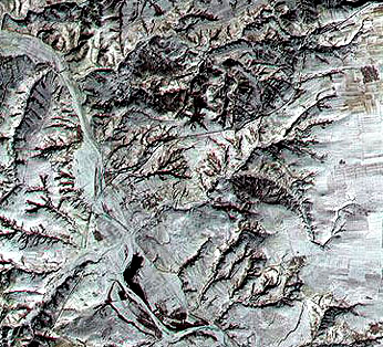
B:In World War II, the Allies soon after the Normandy Invasion of June, 1944 invaded France again from the Mediterranean and moved up the Rhone Valley to join forces. That valley appears here, with the French Alps to the east. The beginning of the French Riviera is along the coast to the east of Marseille (bottom center) and Toulon; the city of Grenoble is at top center in this mosaic.
C: Here Europe (Greece) meets Asia (Turkey) at the famed Dardenelles, a natural waterway connecting the Black Sea (top) with the Sea of Marmosa (bottom) which itself passes into the Aegean Sea at the Bosporus. The SRTM/Landsat scene now includes more of the Aegean Sea and a part of northern Turkey (the Anatolian fault [a San Andreas-like slip fault] is present near the north coast of that country; look for a tendency for certain topographic features to align). The great city of Istanbul (once Constantinople, capital of the Byzantine Empire) is the light toned area around the bottom half of the Dardenelles.
D: The scene straddles the border between northern Tanzania and southern Kenya, in Africa, just to the east of the East African Rift. Most of the land is fairly arid, with limited cultivation, but abundant wildlife. The dominant feature is Mt. Kilimanjaro, which rises to 5894 meters (~19340 ft), as a great volcanic peak. It is ecologically stratified, starting near the base with savanna, a zone of coffee and banana plantings, a montane forest, heather, and an alpine zone above treeline (often snow-covered)
E: The capital of China, Beijing (Peking) extends over a wide area in the right center. The Great Wall of the Inner City, including the Imperial Palace and Tienemman Square, is visible. Beyond the central mountains is the Great Wall of China (actually visible with a magnifying glass on a transparency). However, a Terra ASTER image clearly shows the wall, as a black line running from lower left to upper right, as seen here.
F: Hong Kong, once a British Crown Colony and now part of the Peoples Republic of China, is partly on an island and partly on a peninsula extending to the mainland. The black spot near image center is Canton (Kuangchou) lying near the top of delta formed by the Kiang River that flows into the Chu-kiang estuary. Macao, once a Portugese colony, is near the bottom center. In the SPOT image below, at 20 meter resolution, one new feature is evident to the north of the larger blue area - Kowloon - the central area of Hong Kong: this is a long narrow black line, which is the main runway of the new airport that serves the city.
Kowloon, Victoria Harbor, and part of Hong Kong Island show up in much more detail in this higher resolution (10 m) SPOT composite image. The old airport, with its runway jutting into the harbor, is well remembered by the writer (NMS) as the most “thrilling” landing he’d ever made, as the airplane passes just over the buildings of Kowloon before touching down.

From the hills north of Kowloon, the harbor area looks like this from the ground (photo lies just west of the SPOT subscene):

G: The scene includes parts of the French and Swiss Alps. Lake Geneva, with its cities of Geneva and Lausanne, lies east of the Jura Mountains. Part of Lyon lies on the left edge of the image; below it is the Rhone River. Grenoble is the blue area in the center bottom.
H: This is southern Vietnam. Most of the image shows as solid red, the mark of the vast jungle that proved so difficult for fighting in the Vietnam War. From Bien Hoa, north of Saigon (near lower right) emanates a great plume of smoke from burning oil tanks. The Mekong River (blue) spreads out into the Mekong Delta. (spotchy black pattern indicate swampy water).
I: If you didn’t recognize this “test” image, then we succeeded in “tricking” you or at least demonstrating that you may have forgotten one scene we spent some time on earlier in this Section. This is a Landsat enhanced TM7+ image of London and the Thames estuary. Return to page 6-12 to check out the Landsat image shown there and you will make the connection.