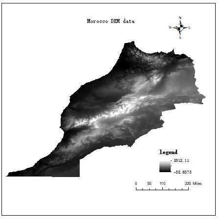
For elevation data of Morocco, SRTM30 dataset, CGIAR-SRTM data aggregated to 30 seconds, data format is Grid, and resolution is aggregated to 30 seconds.The terrain of Morocco is complex, with steep Atlas Mountains in the central and north, upper Plateau and pre-Saharan plateau in the east and south, and only a narrow, low and warm plain along the northwest coast. The highest peak, the Toubugalle Mountains, is 4165 meters above sea level, and the rivers are sparse, with less flow and more intermittent rivers.
Comment list ( 0 )

