Welcome to the IKCEST
Login
|
Register
English
中文
Search
Advanced search
Navigation
Home
Document
Post
Reports
Newsletters
Data
Subject database for earthquake
Subject database for drought
Subject database for flood
Subject database for frozen
Subject database for heat wave
Subject database for wild fire
Subject database for ecology & environment
Subject database for urban
Subject database for social media mining
Subject database for hurricane disaster
Regional basic database for the Belt and Road
Regional disaster database for the Belt and Road
Regional database for China-Mongolia-Russia Economic Corridor
Regional database for China-Pakistan Economic Corridor
Regional database for Bangladesh-China-India-Myanmar Economic Corridor
Maps
China Historical Disaster
Biological Disasters
Geological Disasters
Earthquake Disasters
Meteorologic Disasters
Flood Disasters
Raster Data
Vector Data
Education
Tutorial for GIS
Disaster Knowledge
Presentation
Training Video
Reference report
Disaster news Video
Science Popularization
International Training
Subject-Catalogue
Organization
Experts
Website
Application
Information Aggregation
Application Using Web GIS
Scientific Data Visulization
Natural Science Research Work
Directory
Scholar
ALL
Earthquake
Flood
Drought
Geological disaster
Forest fire
Tsunami
Extreme heat wave
Typhoon
Disaster warning
Disaster risk reduction
Sichuan-Tibet Railway
Home
Regional database for China-Mongolia-Russia Economic Corridor
Publish Data Data
Regional database for China-Mongolia-Russia Economic Corridor
Dataset of precipitation from 1980 to 2010 between China, Russia and Mongolia
Mongolia
spatial interpolation
China
Russia
2023-04-06
This dataset provides average annual precipitation spatial interpolation datas of China, Russia and Mongolia from 1980 to 2010. Th...
Dataset of temperature from 1980 to 2010 between China, Russia and Mongolia
Mongolia
China
spatial interpolation
Russia
temperature dataset
2023-04-06
This dataset provides average temperature spatial interpolation datas of China, Russian, Mongolia from 1980 to 2010. The spatial r...
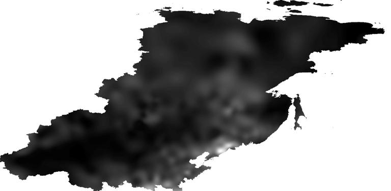
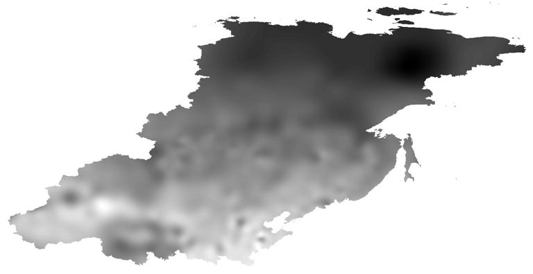
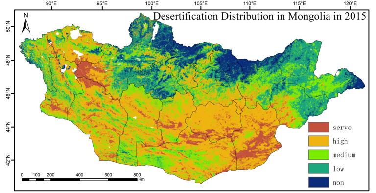
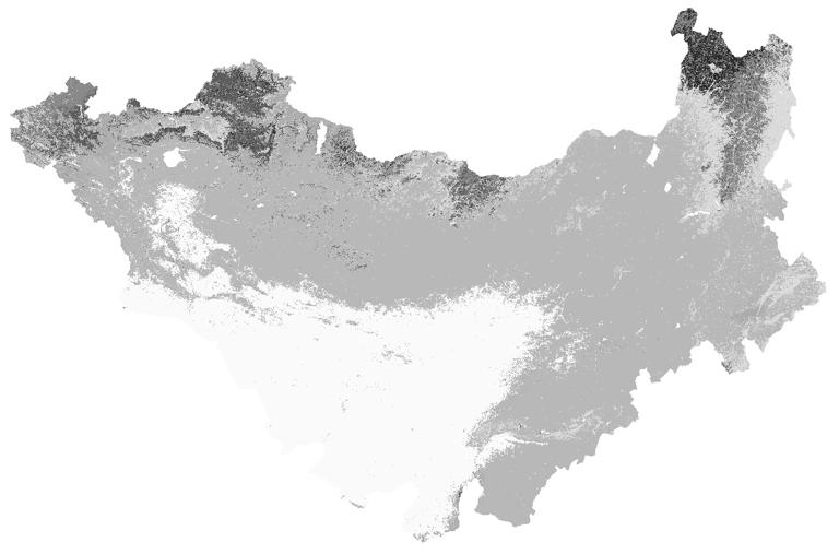
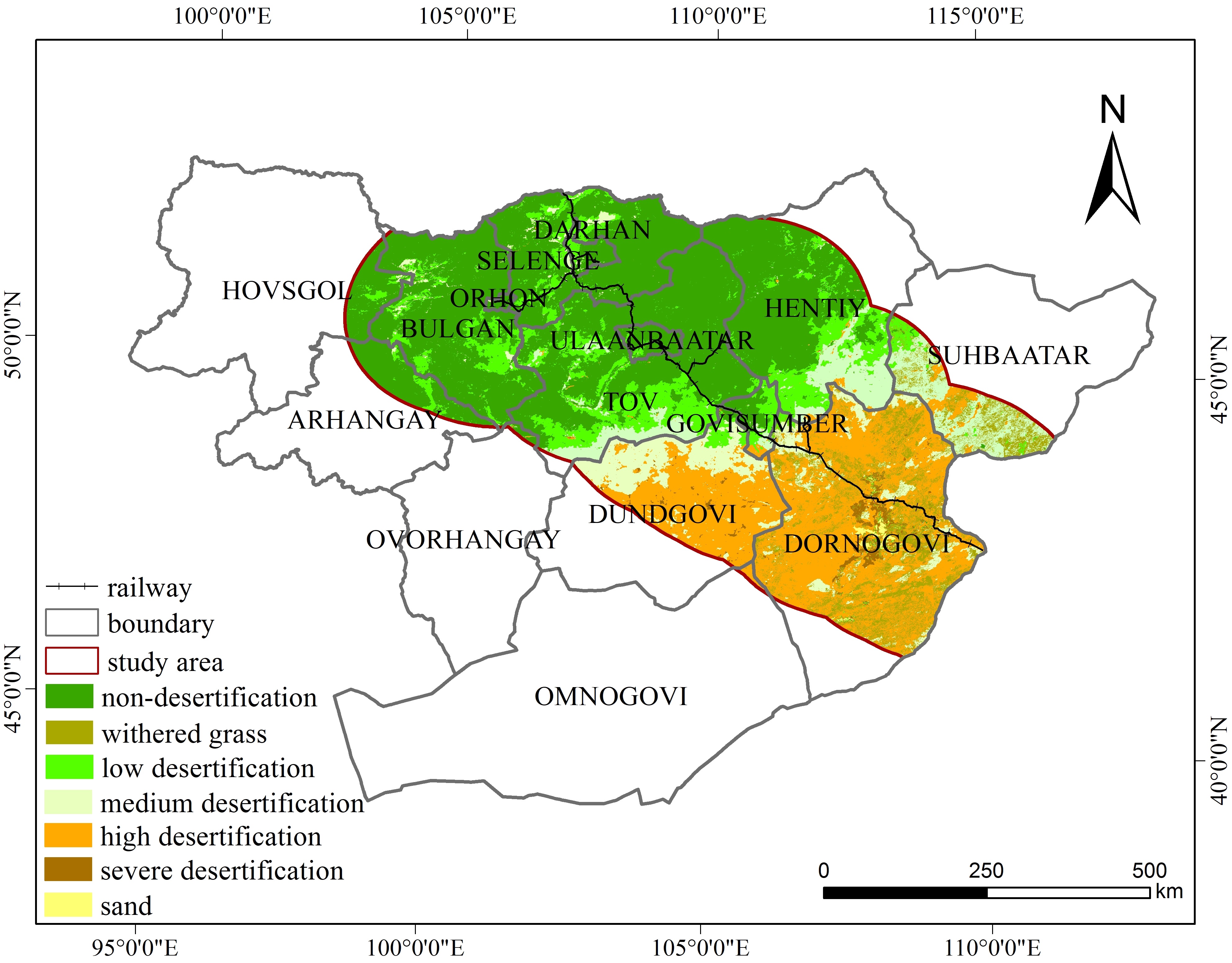
Dataset of Desertification Distribution in Mongolia in 2015 and 2020
Mongolia
Desertification
Geographical division
Characteristic space
Desertification difference index
2023-01-10
This dataset includes data on the degree of desertification in Mongolia for 2015 and 2020 . This dataset was composed of 2 raste...
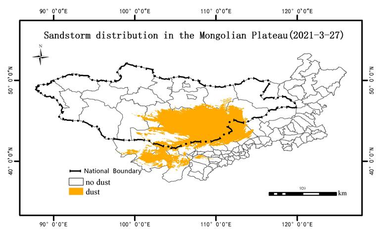
Dataset of spring sandstorm distribution in the Mongolian Plateau from 2000 to 2021
Sand storm
Dust index
no threshold method
MODIS
2023-01-10
The Mongolian Plateau is one of the cradles of many sandstorms in Asia, among which the Gobi region of Mongolia and the desert r...
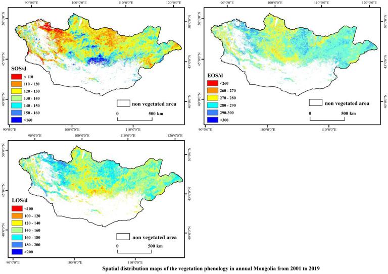
Vegetation Phenology Data Set of Mongolia from 2001 to 2019
vegetation phenology
climate change
Mongolian Plateau
2022-09-28
This data set consists of the annual and average data of the start of growing season (SOS), end of growing season (EOS), and len...
Land degradation data set along the China-Mongolia Railway (Mongolia section)
Land degradation
China-Mongolia Railway (Mongolia section)
2022-09-07
This data set is the distribution data of land degradation along the China-Mongolia Railway (Mongolia section) from 1990 to 2010 a...
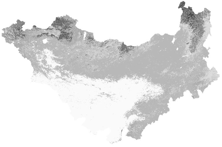
Land cover data of Mongolian Plateau (2001)
Mongolian Plateau
land cover date
projection system
2022-09-07
The Mongolian Plateau, as the largest arid and semiarid Plateau in Northern hemisphere, plays an important role in the climate cha...
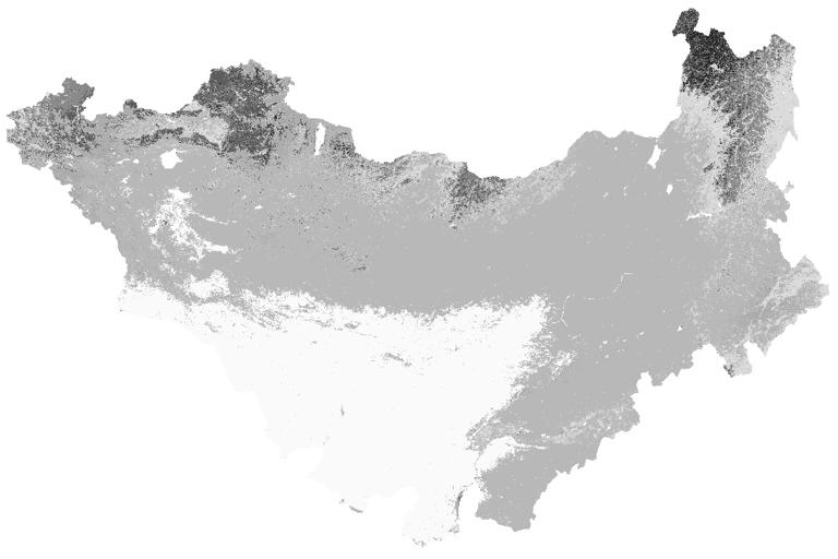
Land cover data of Mongolian Plateau (2005)
projection system
land cover date
Mongolian Plateau
2022-09-07
The Mongolian Plateau, as the largest arid and semiarid Plateau in Northern hemisphere, plays an important role in the climate cha...
Land cover data of Mongolian Plateau (2009)
land cover date
Mongolian Plateau
projection system
2022-09-06
The Mongolian Plateau, as the largest arid and semiarid Plateau in Northern hemisphere, plays an important role in the climate cha...
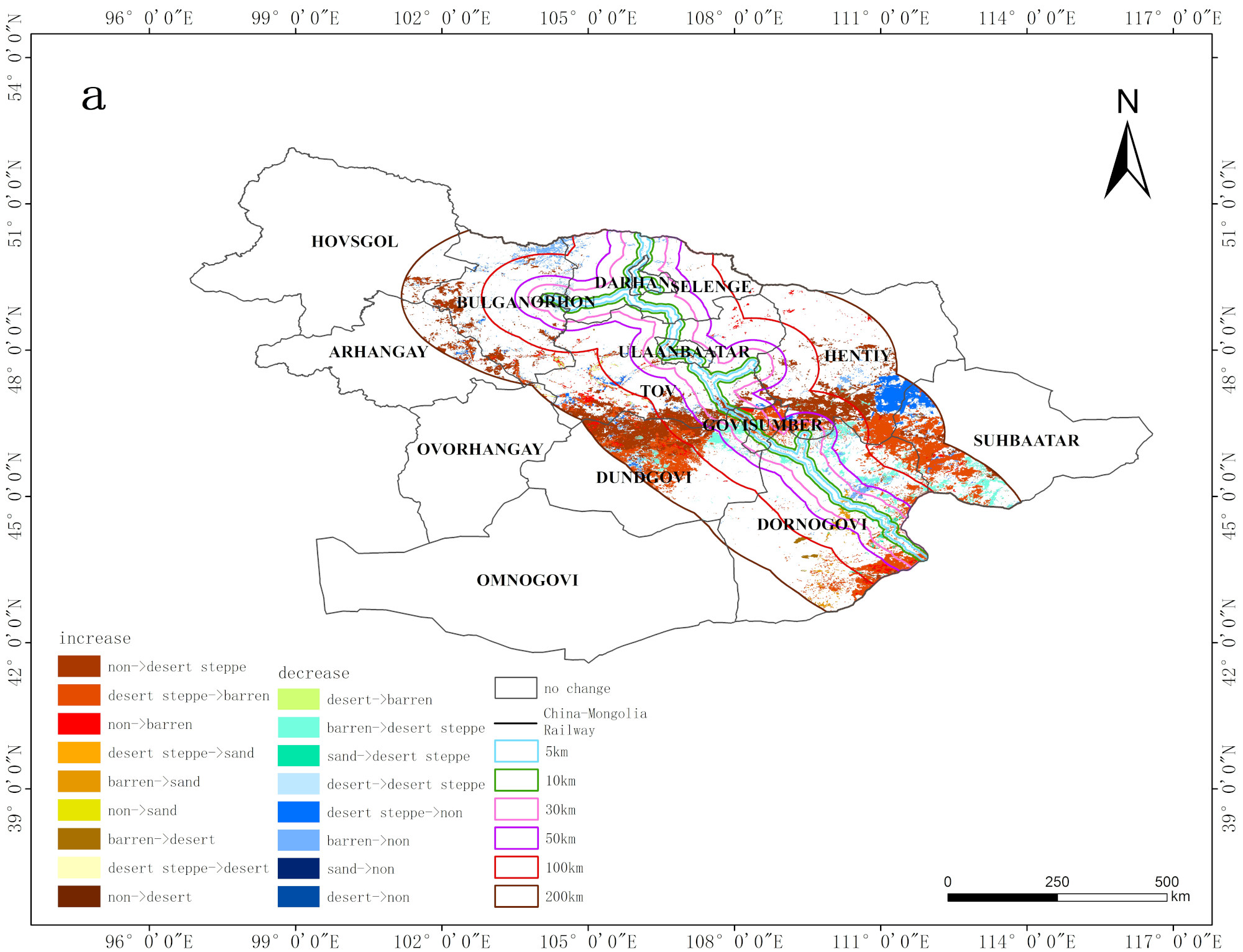
Desertification distribution data set along the China-Mongolia Railway (Mongolia section)
Spatio-temporal Distribution
Desertification Disaster
China-Mongolia railway
2022-09-05
This dataset described the Spatio-temporal Distribution of Desertification Disaster along the China-Mongolia railway (Mongolia sec...
1
2
3
Next page
End
Most concern
Leaf Area Index (LAI): Field Measurements, Remote Sensing Estimation and Validation Studies(2015)
Resources, Environmental and Economic Patterns and Sustainable Development Modes of Silk Road Economic Belt(2015)
The disaster scene of zhouqu mudslide in gansu province
Ecosystem, Climate and Livehood
Spring Festival travel during ice disaster in 2008
Recent articles
2024-02-25:Earthquake Information of 88 km NNW of Tocopilla, Chile
2024-01-29:Earthquake Information of 128 km WNW of Aykol, China
2024-01-22:Earthquake Information of 129 km WNW of Aykol, China
2023-12-02:Earthquake Information of 19 km E of Gamut, Philippines
2023-11-22:Earthquake Information of 97 km E of Port-Olry, Vanuatu
Classified catalogue
Subject database for earthquake
Presentation
Training Video
Subject database for drought
Reference report
Subject database for flood
Subject database for frozen
Paper
Subject database for heat wave
Disaster news Video
Subject database for wild fire
Subject database for ecology & environment
Documents
Subject database for urban
Books
Journal
Subject database for social media mining
Data
Subject database for hurricane disaster
Portal
Regional basic database for the Belt and Road
Regional disaster database for the Belt and Road
Experts
Regional database for China-Mongolia-Russia Economic Corridor
Regional database for China-Pakistan Economic Corridor
Organization
Website
Regional database for Bangladesh-China-India-Myanmar Economic Corridor
Biology
Climatology
Geophysics
Hydrology
Meteorology
Technology
Data List
|
About
|
Contact Us
|
How to use
ICP备案号:京ICP备14021735号-1
© 2008 - 2022 IKCEST All rights reserved