Welcome to the IKCEST
Login
|
Register
English
中文
Search
Advanced search
Navigation
Home
Document
Post
Reports
Newsletters
Data
Subject database for earthquake
Subject database for drought
Subject database for flood
Subject database for frozen
Subject database for heat wave
Subject database for wild fire
Subject database for ecology & environment
Subject database for urban
Subject database for social media mining
Subject database for hurricane disaster
Regional basic database for the Belt and Road
Regional disaster database for the Belt and Road
Regional database for China-Mongolia-Russia Economic Corridor
Regional database for China-Pakistan Economic Corridor
Regional database for Bangladesh-China-India-Myanmar Economic Corridor
Maps
China Historical Disaster
Biological Disasters
Geological Disasters
Earthquake Disasters
Meteorologic Disasters
Flood Disasters
Raster Data
Vector Data
Education
Tutorial for GIS
Disaster Knowledge
Presentation
Training Video
Reference report
Disaster news Video
Science Popularization
International Training
Subject-Catalogue
Organization
Experts
Website
Application
Information Aggregation
Application Using Web GIS
Scientific Data Visulization
Natural Science Research Work
Directory
Scholar
ALL
Earthquake
Flood
Drought
Geological disaster
Forest fire
Tsunami
Extreme heat wave
Typhoon
Disaster warning
Disaster risk reduction
Sichuan-Tibet Railway
Home
Regional disaster database for the Belt and Road
Publish Data Data
Regional disaster database for the Belt and Road
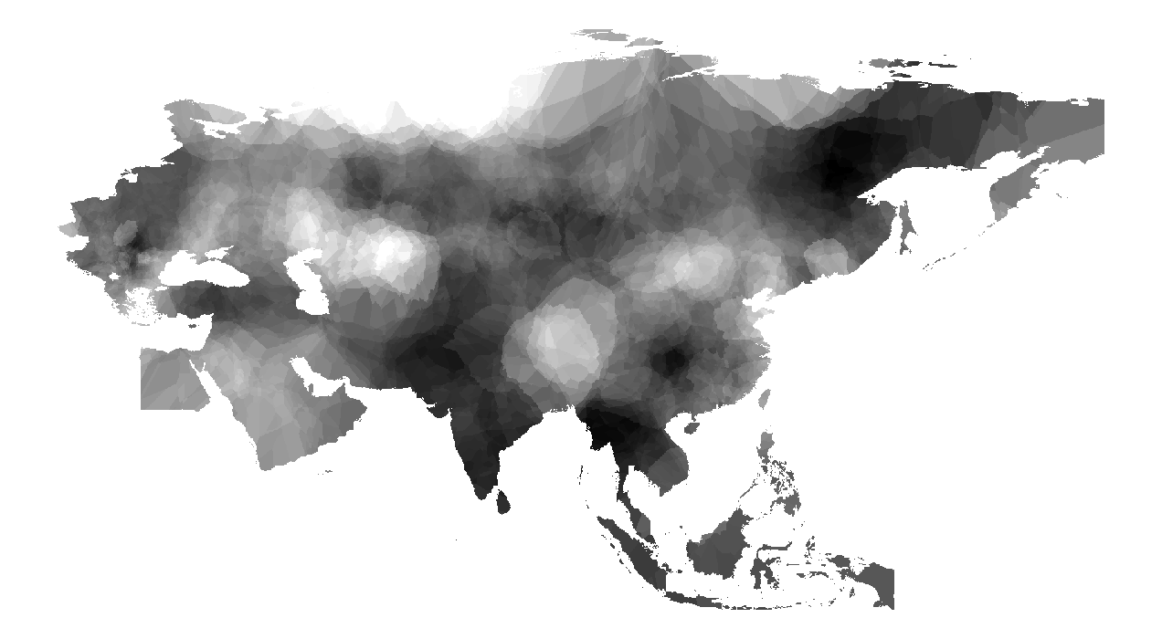
Historical mean wind speed monitoring data set forThe Belt and Road(1989-2018)
mean wind speed
The Belt and Road
2022-09-07
The data set is calculated and interpolated by weather station data. The meteorological site data comes from NOAA, which includes ...
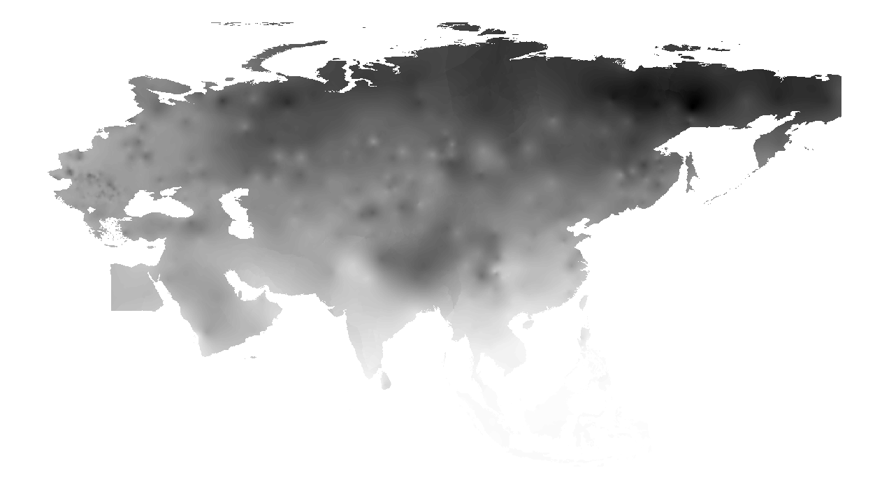
Monthly mean temperature monitoring data sets for The Belt and Road(1989-2018)
mean temperature
The Belt and Road
2022-09-07
The data set is calculated and interpolated by weather station data. The meteorological site data comes from NOAA, which includes ...
Monthly average dew point monitoring data set in The Belt and Road(1989-2018)
The Belt and Road
average dew point
2022-09-06
The data set is calculated and interpolated by weather station data. The meteorological site data comes from NOAA, which includes ...
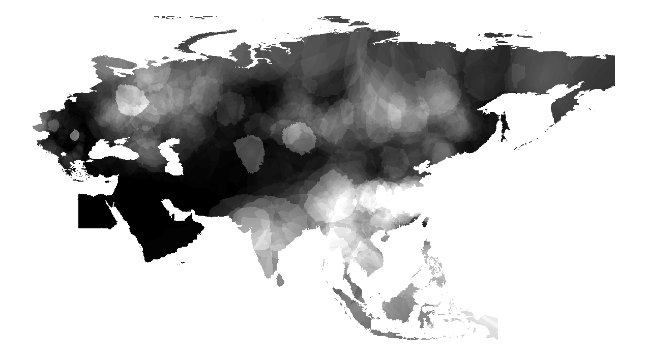
Monthly total precipitation monitoring data set for The Belt and Road(1989-2018)
The Belt and Road
precipitation
2022-09-06
The data set is calculated and interpolated by weather station data. The meteorological site data comes from NOAA, which includes ...
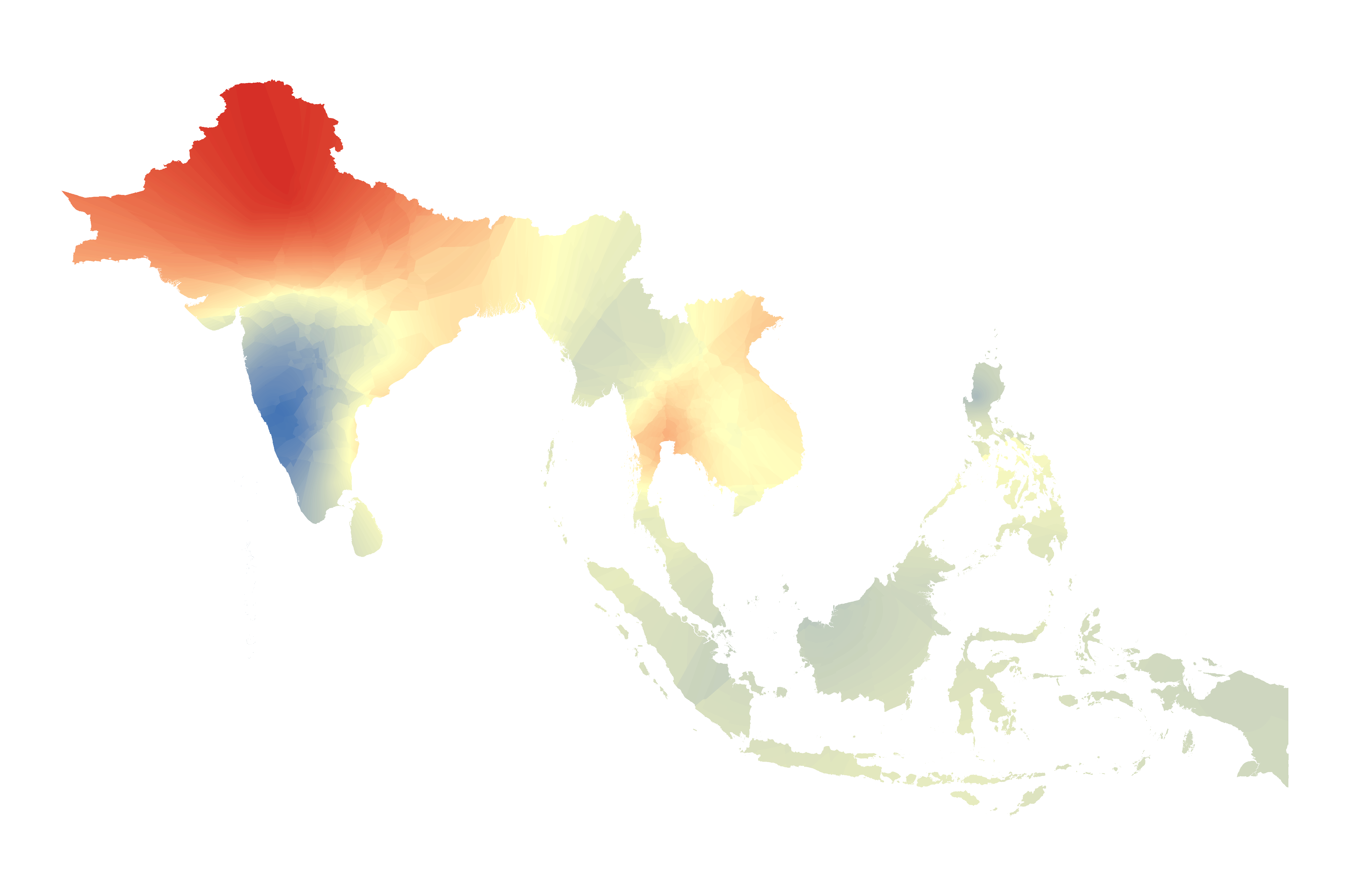
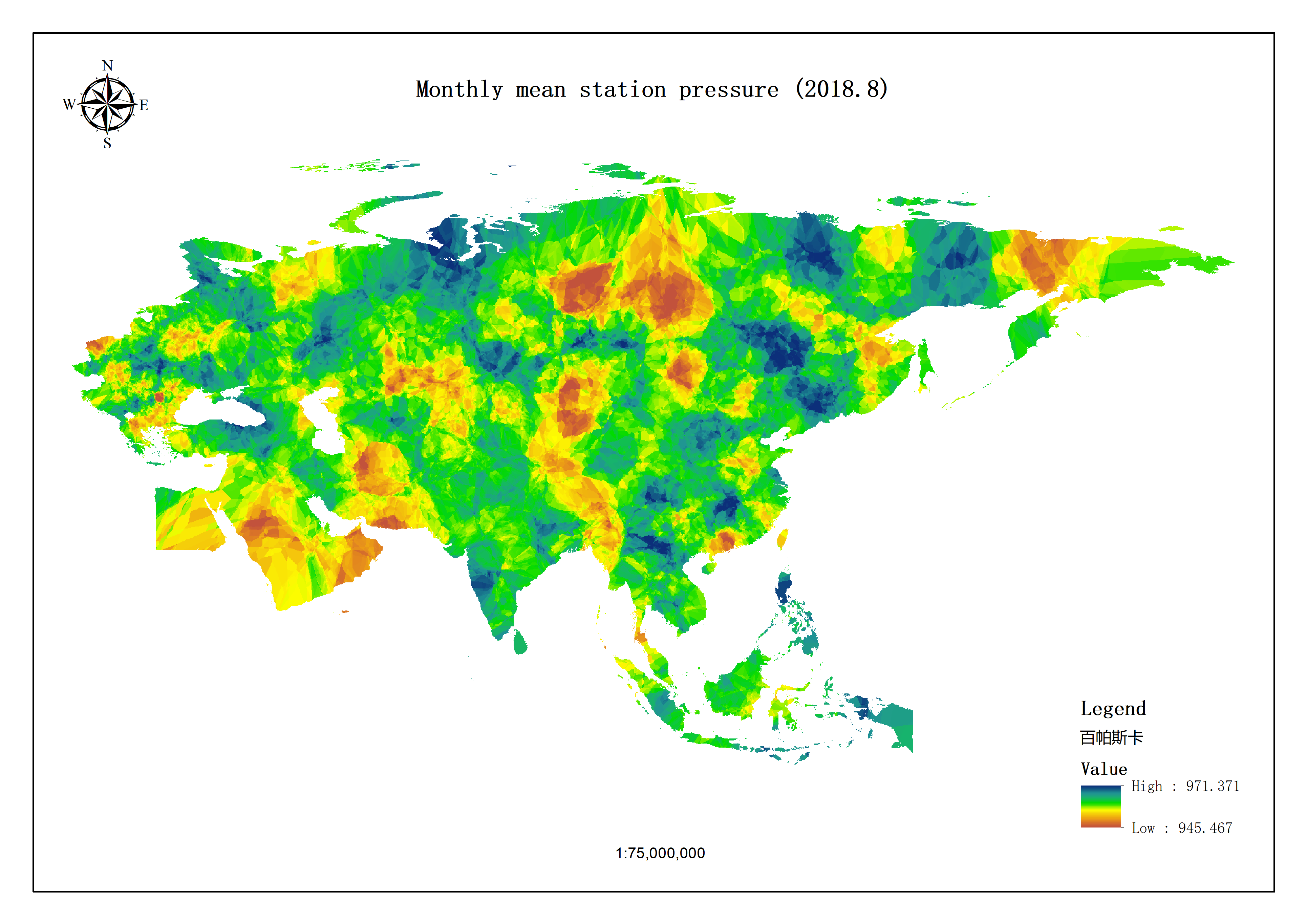
Monthly mean station pressure monitoring data set for south and southeast Asia(1989-2018)
heat wave
South and Southeast Asia
2022-06-17
The data set is calculated and interpolated by weather station data. The meteorological site data comes from NOAA, which includes ...
Monthly maximum temperature monitoring data set for The Belt and Road(1989-2018)
The Belt and Road
maximum temperature
2022-06-17
The data set is calculated and interpolated by weather station data. The meteorological site data comes from NOAA, which includes ...
Monthly minimum temperature monitoring data set for The Belt and Road(1989-2018)
minimum temperature
The Belt and Road
2022-06-17
The data set is calculated and interpolated by weather station data. The meteorological site data comes from NOAA, which includes ...
Monthly average dew point monitoring data set in south and southeast Asia(1989-2018)
heat wave
South and Southeast Asia
2022-06-17
The data set is calculated and interpolated by weather station data. The meteorological site data comes from NOAA, which includes ...
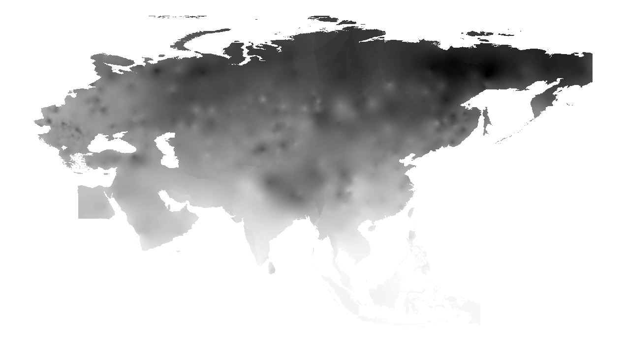
Monthly mean station pressure monitoring data set for One Belt and One Road region (1989-2018)
mean station pressure
The Belt and Road
2022-06-17
The data set is calculated and interpolated by weather station data. The meteorological site data comes from NOAA, which includes ...
Historical mean wind speed monitoring data set for south and southeast Asia (1989-2018))
South and Southeast Asia
heat wave
2022-06-17
The data set is calculated and interpolated by weather station data. The meteorological site data comes from NOAA, which includes ...
1
2
3
4
5
Next page
End
Most concern
Leaf Area Index (LAI): Field Measurements, Remote Sensing Estimation and Validation Studies(2015)
Resources, Environmental and Economic Patterns and Sustainable Development Modes of Silk Road Economic Belt(2015)
The disaster scene of zhouqu mudslide in gansu province
Ecosystem, Climate and Livehood
Spring Festival travel during ice disaster in 2008
Recent articles
2024-02-25:Earthquake Information of 88 km NNW of Tocopilla, Chile
2024-01-29:Earthquake Information of 128 km WNW of Aykol, China
2024-01-22:Earthquake Information of 129 km WNW of Aykol, China
2023-12-02:Earthquake Information of 19 km E of Gamut, Philippines
2023-11-22:Earthquake Information of 97 km E of Port-Olry, Vanuatu
Classified catalogue
Subject database for earthquake
Presentation
Training Video
Subject database for drought
Reference report
Subject database for flood
Subject database for frozen
Paper
Subject database for heat wave
Disaster news Video
Subject database for wild fire
Subject database for ecology & environment
Documents
Subject database for urban
Books
Journal
Subject database for social media mining
Data
Subject database for hurricane disaster
Portal
Regional basic database for the Belt and Road
Regional disaster database for the Belt and Road
Experts
Regional database for China-Mongolia-Russia Economic Corridor
Regional database for China-Pakistan Economic Corridor
Organization
Website
Regional database for Bangladesh-China-India-Myanmar Economic Corridor
Biology
Climatology
Geophysics
Hydrology
Meteorology
Technology
Data List
|
About
|
Contact Us
|
How to use
ICP备案号:京ICP备14021735号-1
© 2008 - 2022 IKCEST All rights reserved