Label : MongoliaDesertificationGeographical divisionCharacteristic spaceDesertification difference index
Date: 2023-01-10
View counts: 693
Browse document: Browse document
Download Dataset: Log in
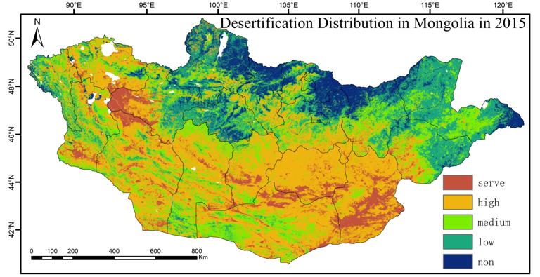
This dataset includes data on the degree of desertification in Mongolia for 2015 and 2020 . This dataset was composed of 2 raster files. They are produced by the Institute of Geographical Sciences and Natural Resources Research of the Chinese Academy of Sciences.Based on Landsat8 data with 30m resolution, a combined geographic partitioning and feature space approach was used to complete the fine extraction of desertification in Mongolia in 2015 and 2020 with Google Earth Engine (GEE) platform, which Albedo-NDVI, Albedo-MSAVI, and Albedo-TGSI feature space models are used in high, medium-low, and very low vegetation cover areas of Mongolia, respectively. The dataset visually reflects the spatial distribution of land with different degrees of desertification in Mongolia, which can provide detailed and reliable data support for the delineation of key areas for desertification control and the formulation of restoration strategies in Mongolia, and is of great significance for the ecological environment and green sustainable development of the China-Mongolia-Russia Economic Corridor.
Comment list ( 0 )

