Login   |      Register
English    中文


Fractional vegetation cover dataset in Amur River Basin (China) (2001-2019)


Fractional vegetation cover dataset in Amur River Basin (China) (2001-2019)

Label :

Date: 2022-09-26

View counts: 1363

Browse document: Browse document

Download Dataset: Log in

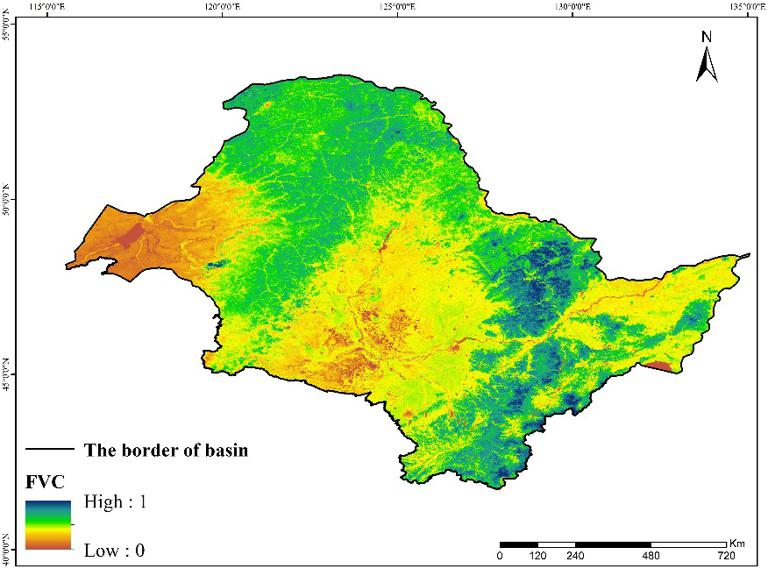
This dataset described the spatial distribution of fractional vegetation cover in the Amur River basin (China), which includes Heilongjiang and Jilin province. They were collected and organized by the Institute of Geographic Sciences and Natural Resources Research, Chinese Academy of Sciences. This dataset was composed of 19 raster files. It can be used to study vegetational condition and provide important basis for disaster prevention and reduction and reducing the negative effects of meteorological disasters.

Format
tif
Contributor agency
Institute of Geographic Sciences and Natural Resources Research, Chinese Academy of Sciences
Contributor email
ikcest-drr@lreis.ac.cn
Country id
CN
Data citation
Fractional vegetation cover dataset in Amur River Basin (China) (2000-2019)Disaster Risk Reduction Knowledge Service of International Knowledge Centre for Engineering Sciences and Technology (IKCEST) under the Auspices of UNESCO, 2022.
Data record num
6.62GB
Resperson name
Service group of Disaster Risk Reduction Knowledge Service System of IKCEST
Responsible address
A11 Datun Road, Chaoyang District, Beijing
Responsible email
ikcest-drr@lreis.ac.cn
Responsible postcode
100101
Responsible telephone
010-64889048-8006
Last Modified
2022

    Sign in for comments!

Comment list ( 0 )


Information evaluation