Login   |      Register
English    中文


Dataset of changes in spatial distribution of polders around Dongting Lake, China (1949–2013)


Dataset of changes in spatial distribution of polders around Dongting Lake, China (1949–2013)

Label :

Date: 2017-09-28

View counts: 7110

Browse document: Browse document

Download Dataset: Log in

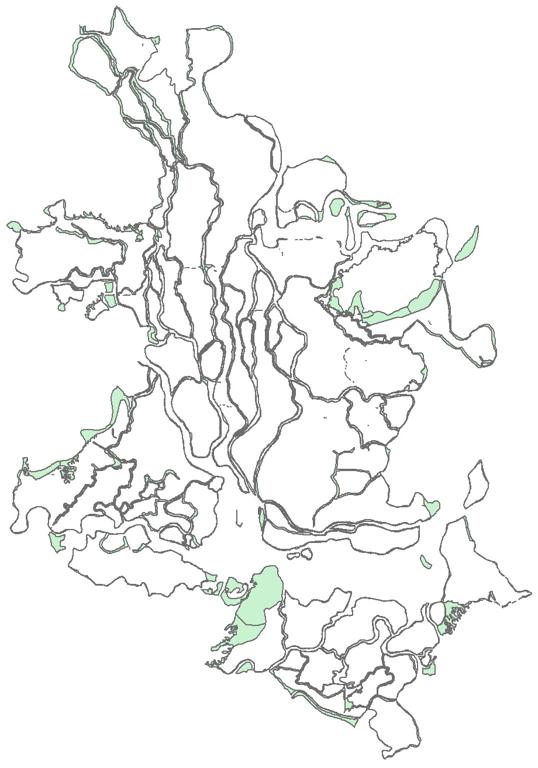
Long-term sediment deposition and embankment reclamation have formed a special distribution of polders around Dongting Lake in China. The area encompassed by the dataset includes 20 counties around Dongting Lake. The dataset content includes the polder distribution in 2013 and the spatial changes during 1949–1998, 1998–2008, and 2008–2013. The 2013 polder distribu-tion was extracted using object-oriented image classification using remotely sensed images. In-formation about spatial changes in the polders during the three historical periods was extracted from water-conservancy engineering drawings and related materials using automatic vectoriza-tion and the ArcGIS software. The dataset could be used to look for temporal and spatial patterns, explain the process of polder evolution, investigate land use and its changing patterns, and for-mulate corresponding policies for managing polders in the Dongting Lake area.

Topicategory
Geography
Language
English
Time begin
1949
Time end
2013
Contributor
Wang Juanle, Gao Mengxu, Guo Haihui, Chen Eryang. Email: ikcest-drr@lreis.ac.cn
Organization
Institute of Geographic Sciences and Natural Resources Research, Chinese Academy of Sciences.
Access constraints
Sharing Type: Open
Contributor agency
Institute of Geographic Sciences and Natural Resources Research, Chinese Academy of Sciences
Contributor email
ikcest-drr@lreis.ac.cn
Country id
CN
Data citation
Dataset of changes in spatial distribution of polders around Dongting Lake, China (1949–2013). Disaster Risk Reduction Knowledge Service of International Knowledge Centre for Engineering Sciences and Technology (IKCEST) under the Auspices of UNESCO, 2014.12.30. http://drr.ikcest.org/info/8927.
Data record num
28.3MB
Resperson name
Service group of Disaster Risk Reduction Knowledge Service System of IKCEST
Responsible address
A11 Datun Road, Chaoyang District, Beijing
Responsible email
ikcest-drr@lreis.ac.cn
Responsible postcode
100101
Responsible telephone
010-64889048-8006

Data Visualization on Map

Central point longitude
112.270
Central point latitude
29.333
Max zoom level
7
Min zoom level
1
Current zoom level
6


    Sign in for comments!

Comment list ( 0 )