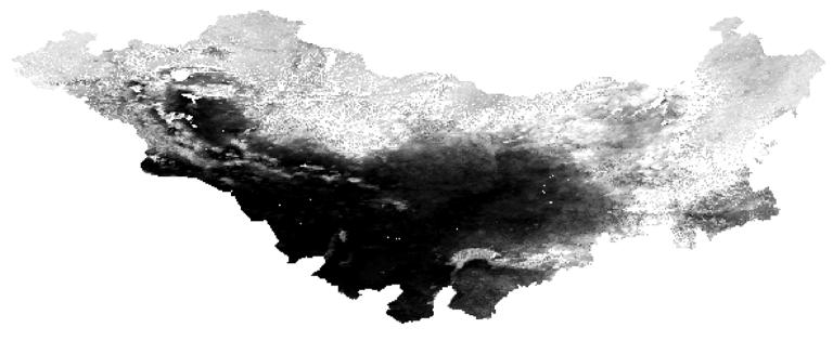
Login   |      Register
English    中文


Surface vegetation coverage data in Mongolian Plateau


Surface vegetation coverage data in Mongolian Plateau

Label :

Date: 2017-07-20

View counts: 7118

Browse document: Browse document

Download Dataset: Log in

The Mongolian Plateau, as the largest arid and semiarid Plateau in Northern hemisphere, plays an important role in the climate changes and sustainable development of the ecological environment. This dataset provides the surface vegetation coverage from 1981 to 2012 in Mongolia plateau, which is based on vegetation index date. It includes NDVI-PathFinder dates from 1981 to 1999 and MODIS data from 2000 to 2012. The overall accuracy of the data set is 75%.

Topicategory
Geography
Language
English
Contributor
Cao Xiaoming, Wang Juanle Email: ikcest-drr@lreis.ac.cn
Organization
Institute of Geographic Sciences and Natural Resources Research, Chinese Academy of Sciences.
Access constraints
Sharing Type: Open
Contributor agency
Institute of Geographic Sciences and Natural Resources Research, Chinese Academy of Sciences
Contributor email
ikcest-drr@lreis.ac.cn
Country id
MN
Data citation
Surface vegetation Coverage data in Mongolia Plateau. Disaster Risk Reduction Knowledge Service of International Knowledge Centre for Engineering Sciences and Technology (IKCEST) under the Auspices of UNESCO, 2014.12.30. http://drr.ikcest.org/info/14e0.
Data record num
2938.9MB
Resperson name
Service group of Disaster Risk Reduction Knowledge Service System of IKCEST
Responsible address
A11 Datun Road, Chaoyang District, Beijing
Responsible email
ikcest-drr@lreis.ac.cn
Responsible postcode
100101
Responsible telephone
010-64889048-8006

    Sign in for comments!

Comment list ( 0 )


Information evaluation