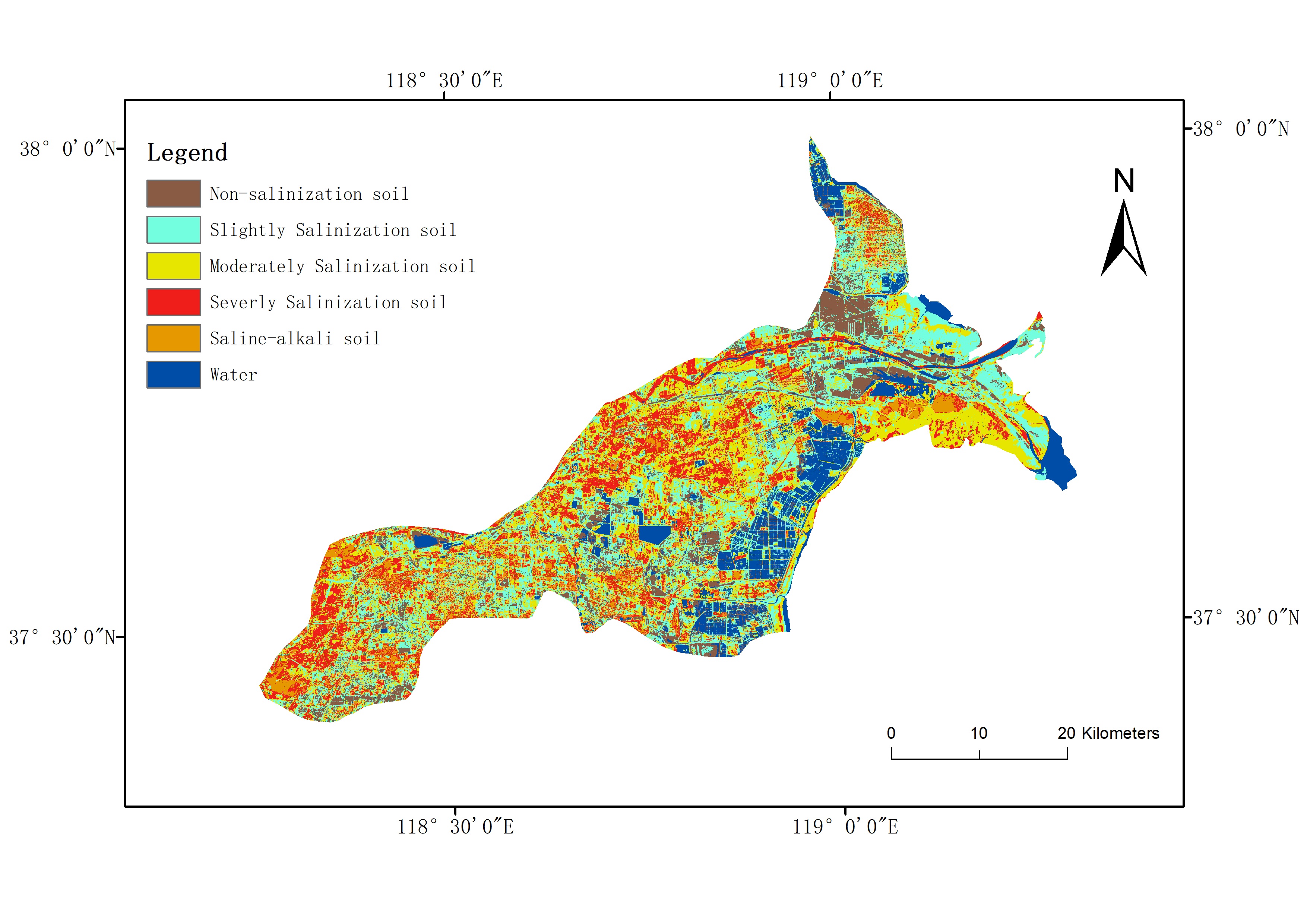
Login   |      Register
English    中文


Kenli County Salinization Data (2014)


Kenli County Salinization Data (2014)

Label :

Date: 2019-12-25

View counts: 7270

Browse document: Browse document

Download Dataset: Log in

The data source for this dataset is USGS Landsat 8 OLI data. The spatial resolution is 30 meters, and after image processing such as radiometric calibration and atmospheric correction, the inversion data of the Kenli County in 2014 was obtained.

Topicategory
Environmental science, earth science
Language
Chinese
Format
Excel 、 Tiff
Contributor
Bian Lingling,WangJuanle
Organization
Institute of Geographic Sciences and Natural Resources Research, Chinese Academy of Sciences.
Access constraints
Sharing Type: Fully opened sharing
Date creation
2019.10.17
Source
USGS Landsat 8 OIL
Distance value
China
Contributor agency
Institute of Geographic Sciences and Natural Resources Research, Chinese Academy of Sciences
Contributor email
ikcest-drr@lreis.ac.cn
Country id
CN
Data citation
Kenli County Salinization Data (2014), Disaster Risk Reduction Knowledge Service of International Knowledge Centre for Engineering Sciences and Technology (IKCEST) under the Auspices of UNESCO,2019.9.25.http://drr.ikcest.org/info/9a502
Data record num
79.3MB
Resperson name
Service group of Disaster Risk Reduction Knowledge Service System of IKCEST
Responsible address
A11 Datun Road, Chaoyang District, Beijing
Responsible email
ikcest-drr@lreis.ac.cn
Responsible postcode
100101
Responsible telephone
010-64889048-8006
Last Modified
2019.10.17

Data Visualization on Map

Central point longitude
118.823
Central point latitude
37.654
Max zoom level
9
Min zoom level
1
Current zoom level
8


    Sign in for comments!

Comment list ( 0 )


Information evaluation