Other Remote Sensing Systems - IRS, JERS, RESURS, OKEAN, CBERS, MicroSat Series (AlSat-1)
Contents
Other countries are now active in the satellite remote sensing “game”. India has launched four satellites, the IRS series, each with multispectral sensors. Japan is operating two satellites, the JERS series, with sensors that cover much the same spectral regions as the Landsat TM, but at higher resolution. The Russians with their RESURS series now offer imagery similar to Landsat and some meteorological satellites. The Ukraine has launched its own OKEAN satellites. China and Brazil have jointly developed the CBERS series. A series of Microsats, destined to be used as disaster monitors, are being placed in orbit, the first now operational is AlSat-1.
Other Remote Sensing Systems - IRS, JERS, RESURS, OKEAN, CBERS, MicroSat Series (AlSat-1)
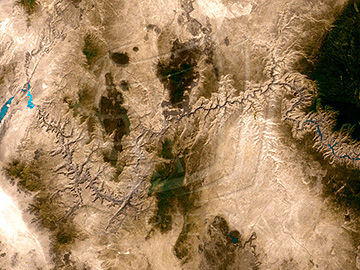
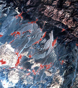
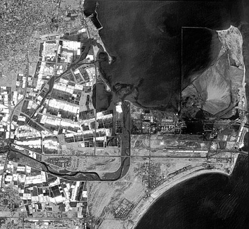
India successfully operates several Earth-resources satellites that gather data in the Visible and Near IR bands, beginning with IRS-1A in March of 1988. The latest in the series, IRS-1D, launched on September 29, 1997. Its LISS sensor captures radiation in the blue-green, green, red, and near IR bands at 23 m spatial resolution. The spacecraft also produces 5.8 m panchromatic images, as well as 188 m resolution wide-field (large area) WiFS multispectral imagery. Below are three recent images from this system, the one on the top (WiFS) showing the Grand Canyon of Arizona, in the middle a three-band color composite made by the 23 m LISS, showing mountainous terrain and pediments with alluvium fans in southern Iran, and at the bottom a 5.8 meter panchromatic view of part of the harbor at Tamil Nadu in India.
More information on the Indian remote sensing program is available from its U.S. distributor, Space Imaging, Inc. (http://www.spaceimaging.com).
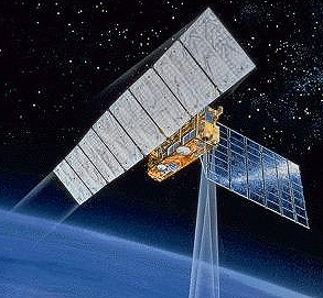
The Japanese, beginning in 1990, have flown JERS-1 and JERS-2 which include optical and radar sensors. Here is an artist’s conception of JERS-1 in space:
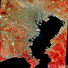
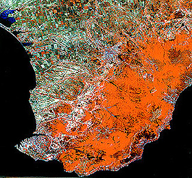
Starting in the mid 1980s, the Soviet Union (and now Russia) entered the world arena with an Earth-observing satellite program available on the open market. The RESURS-01 series (3 so far, a fourth pending) provided a multispectral system (3 Vis-NIR bands; 2 thermal) whose resolution (160 m, and 600 m for thermal) is intermediate between that of Landsat/SPOT and the AVHRR on meteorological satellites. Like Landsat RESURS are placed in near-polar, sun-synchronous orbits. Two images from this system appear below: the first is a false color composite Moscow and its surroundings.
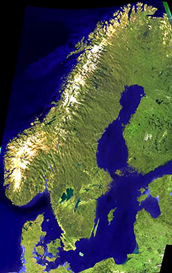
The second RESURS (Resources) image is part of a mosaic of Europe which here includes all of Norway, Sweden, and Denmark, and part of Finland and several Baltic nations.
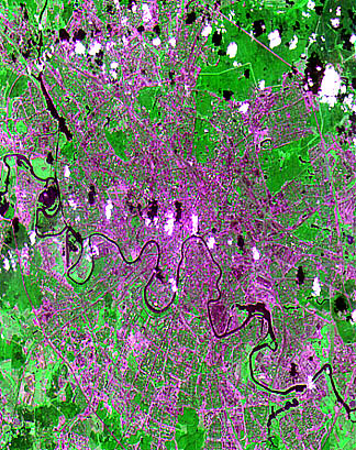
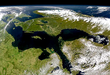
This general region has recently been scanned by the SeaWiFS sensor or OrbView-2 (see page 14.3) and rendered as an oblique perspective view:
The National Space Agency of the Ukraine has its own program of space observations; it works in cooperation with the Russian Federation in using certain facilities. Its OKEAN series includes multispectral scanners, thermal sensors, and radar. Two MSU-V images (50 m resolution) show a standard false color composite (left) of the southern Crimea (Sebastapol in lower left) and a different color combination (right) of the Dnieper River in the Ukraine Lowlands, with Kiev just below the upper “lake” (caused by river damming).

The Peoples Republic of China has joined forces with the Brazilian government to develop a series of earth-observing satellites launched by Long March rockets from China. Their program goes by the name of CBERS (China-Brazil Earth Resources Satellites); in China these satellites are called the Zujuan series. CBERS-1 was orbited on October 14, 1999. It includes three sensors: 1) WFI (300 km swath; 260 m resolution; 4 bands); 2) IR-MSS (20 km swath; 80 m resolution; 4 bands including thermal); and 3) CCD (20 m resolution; 4 bands). The more than 280000 images received are concentrated mainly over Brazil and China and are not generally available to other nations. CBERS-2 (YZ-2) was launched on September 1, 2000; although reputed to be available for earth resources applications, western observers have concluded that its 3-meter resolution sensor is being used primarily for military reconnaissance. Here is a CBERS-1 CCD image of an (unidentified) area in Brazil:

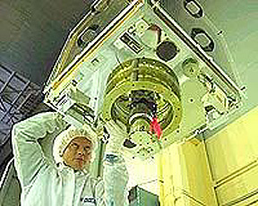
The British, in cooperation with the various national space agencies, have developed a program that is inserting into (700 km altitude) orbits a series of small (440 kilograms [200 lbs]) but versatile satellites (because of their size, referred to as Microsatellites consisting of a single sensor that can image in the green, red, and near IR wavelength band intervals. This is the DMC (Disaster Monitoring Consortium) program which will (as now planned by the end of 2003) have four similar satellites in staggered orbits that have spacings and repeat cycles which allow any location on Earth to be visited once during a 24 hour period. The sensor can cover an area 600 x 600 km (roughly, 400 miles on a side) in dimension at a resolution of 34 km. Higher resolution - smaller area - coverage is also an option. While capable of many scene monitoring and classification tasks, the prime utilization which is the “selling point” for this system of “formation flying” satellites (see page 16-11) is to obtain images that (if clouds are not a hindrance) can see damage or other consequences of a group of natural or manmade disasters detectable at the resolutions available. The first satellite (AlSat-1) was built at Surrey, England for operation by Algeria. This is AlSat-1 seen in its fabrication room.
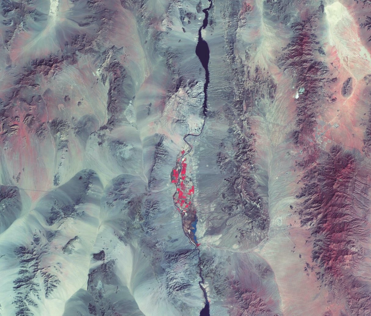
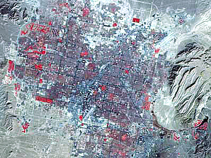
An image encompassing part of the U.S. Southwest from ALSat-1 appeared at the bottom of page Overview-2. Below are two more ALSat-1 images, the first including the land adjacent to Colorado River between Arizona and California and the second a smaller area view of Las Vegas, Nevada.
Others in this series are BilSat (Turkey), UK-DMC (England), NigeriaSat (Nigeria), and ThakPaht (Thailand).