Geological Map of Gansu Province, China
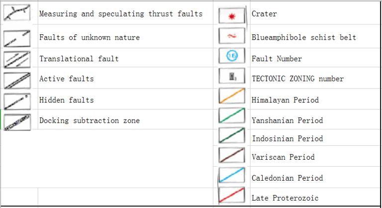
Map of Fault System and Structural Zoning in Gansu Province
Siberian Plate:
Variscan fold belt in Tianshan-Inner Mongolia-Xingan Mountains
The North Variscan Fold Zone in Hongshishan Mountains
Tarim Plate:
South Hualixi Fold Zone in Hongshishan Mountains
Gongpoquan Caledonian fold belt (trench-arc-basin system)
Star Gorge-Tiancang Caledonian Uplift
Liuyuan-Jiusidun Caledonian marginal rift trough
Variscan rift trough in the southern margin of Beishan Mountains
Tarim Platform:
Dunhuang Block
North China Plate:
North China Platform
Alxa Block
Caledonian fold belt (continental slope) on the southern margin of Alashan
Ordos uplift
Caledonian fold belt in Qilian Mountains
North Qilian Mountain Fold Zone
Middle Qilian uplift
South Qilian fold belt (back-arc basin)
Early Indosinian fold belt (epicontinental sea basin) in Hunan Mountains, Qinghai Province
Caledonian fold belt in the North Qinling Mountains
Flame Hill Rise
Dangchuan fold belt
South China Plate:
Variscan-Indosinian fold belt in the Western Qinling Mountains
Hualixi Fold Belt (Foreland Basin) in the Middle Qinling Mountains
Indosinian fold belt in South Qinling Mountains
Yangtze Platform:
Mesoproterozoic fold belt in Bikou (trench-arc-basin system)
Comment list ( 0 )

