
Basic problems of Spatial Data Model
The real world where human life and production is composed of things or entities, and it has a complex structure. As far as a systematic point is concerned, the state of motion (the character and situation in a particular space-time) and the mode of motion (the pattern and law of the change of the state of motion with time and space) of space objects or entities are constantly changing. There are also interactional and interdependent relationships among many elements (entities) of the system, such as population, material, energy, information, etc. The flow and function of value reflect different spatial phenomena and problems. In order to control and regulate the material flow, energy flow and human flow of the space system, it need to transfer them to the desired state and mode and to achieve dynamic balance and sustainable development, people begin to consider the digital simulation and dynamic analysis of the spatial state, interdependence, change process, interaction law, feedback principle and modulation mechanism of the elements. It provides a good application environment and an important driving force for the development of Geographic Information System.
concept
Geographic data can also be called spatial data. Geospatial space refers to the distribution mode and pattern of material, energy and information in form, structural process, functional relationship and its continuation in time. Geographic space in GIS can be divided into absolute space and relative space. Absolute space is a set of spatial locations described by attributes, which consists of a series of coordinate values of different locations. Relative space is a set of entities with spatial attributes, which is composed of spatial relations between different entities. In the application of geographic information system, the concept of space runs through the whole work object, work process, work results and other parts. Spatial data is data obtained in different ways and sources, such as maps, thematic maps, images, statistical data, etc. These data have the characteristics of determining the spatial location.
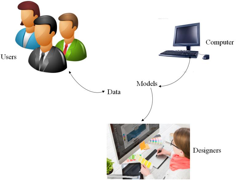
Spatial data model is a concept about spatial entities and their relationships in the real world. It provides a basic method for describing the organization of spatial data and designing spatial database patterns. Therefore, the understanding and research of spatial data model plays an important role in the design of GIS spatial database and the development of a new generation of GIS system (Figure 3-1).
Types of spatial data models
The three information models related to spatial information in GIS are object-based (feature) model, network model and field model. Object-based (element-based) models emphasize discrete objects, which can be described in detail according to their boundary lines and other objects that constitute them or are related to them. The network model represents the interaction between special objects, such as water or traffic flow. Field models represent data that are considered to be continuously changing in two-dimensional or three-dimensional space.
There are many types of data, sometimes seen as fields, sometimes as objects. Choosing one model instead of another is mainly based on the measurement method of data. If the data comes from satellite imagery, one of the values of a phenomenon is mainly provided for each location in the region, such as crop type or forest type, a field-based view can be adopted. If the data is measured in the way of regional boundary lines and the region is considered to be consistent within the region, a factor-based view can be adopted, if the classification space is divided. As a rough subclass, a field-based model can be transformed into a factor-based model, because the latter is more suitable for the measurement and analysis of features of discrete surfaces or lines.
The academic frontier of GIS Spatial Data Model
Spatio-temporal data model, three-dimensional data model, dynamic spatial data structure, distributed spatial data management, spatial access methods, CASE tools designed by GIS are the academic frontiers in the research of GIS spatial data model in the world.
Spatio-temporal data model
The core issue of spatiotemporal data model is to study how to effectively express, record and manage real world entities and their interrelationships changing over time. There are three possible changing forms of space-time, the one is the change of attributes, whose spatial coordinates or positions are unchanged. The other is the changing spatial coordinates or positions, while attributes are unchanged. The change of spatial coordinates or positions can be either the change of the position, direction, size, shape of a single entity or the change of the relationship between two or more spatial entities. The third is the changing coordinates and attributes of spatial entities or phenomena. At present, the main problems of temporal GIS research are data model expressing spatial and temporal changes, organization and access methods of spatial and temporal data, version of spatial and temporal database, quality control of spatial and temporal database, visualization of spatial and temporal data, etc.
Three-dimensional spatial data model
International research on three-dimensional spatial data model can be divided into two directions: one is three-dimensional vector model, which uses some primitives and their combinations to represent three-dimensional spatial objects. These primitives themselves can be described by simple mathematical analytic functions. The other is the volume model represented by voxel model, it is easy to express the unbalanced changes of three-dimensional spatial attributes. Its shortcomings are large storage space and long processing time.
Distributed Spatial Data Model
Distributed spatial database management system and federated spatial database are two main research directions of distributed spatial data model in the world.
1) Distributed Spatial Database Management System
Distributed spatial database management system is a combination of spatial database technology and computer network technology. The system uses computer network to distribute data and programs of spatial database connected by communication lines, so as to achieve the unification of centralization and distribution. That is to say, distributed spatial database management system integrates distributed spatial database. The main problems include spatial data segmentation, distributed query and distributed concurrency control.
2) Federated Spatial Database
The federated spatial database is a federated spatial database management system, which combines heterogeneous spatial database systems into one without changing the spatial database management systems from different sources, and provides users with a unified view.
CASE tools
CASE tool is an important tool for structured analysis of computer information system, description of data flow, expression of data entity relationship, generation of data dictionary and system prototype, and generation of original code. It is widely used in the design and establishment of non-spatial computer information system. At present, according to the characteristics of GIS spatial data modeling and the principle of CASE tools, an important development direction in the world is to develop the special functions of GIS spatial data modeling and system design on the existing CASE software platform, which will effectively improve the automation and technical level of GIS spatial data modeling and its application system design.
